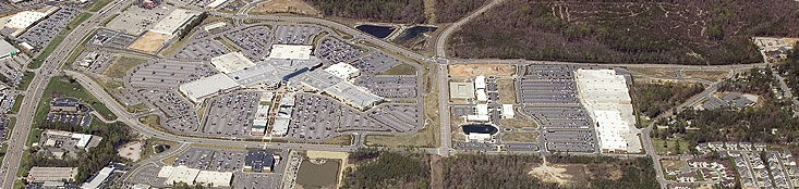
Services
: Resource
Management & Data Analysis |
Mitigation Mapping
In
the course of planning new construction or to analyze the
effects of natural disasters, specialized topographic and
planimetric maps are important tools. The very purpose
of mitigation maps are to lessen the impact of sudden alterations
to an area, whether man-made or natural processes. Wetland
verification, flood hazard zone and highway construction
are some of the specialized services that TAS is adept
at providing to both the private and public sectors.
Drainage and watershed information can be quickly and
efficiently produced by photogrammetric methods, putting
the data pertinent to the client into an easily-interpreted
visual format. |
| |
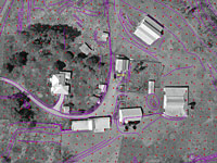
Sample Project:
A-0009WM Skeenah Creek, Macon County
Triangle Aerial Surveys was awarded a project by the
North Carolina Department of Transportation (NCDOT)
to perform Mitigation mapping on Skeenah Creek within
Macon County, North Carolina. Black and white
aerial imagery was provided along with surveyed ground
control to complete topographic mapping at a scale
of 1”=100’ along with DTM data. The
project was done to NCDOT plan sheet specifications
and included the generation of 1’ contours. Digital
files were provided to NCDOT in two-dimensional and
three-dimensional formats. |
| |
Sample Project:
U-3109WM Cates Farm, Alamance County
 Triangle
Aerial Surveys received a project for mitigation mapping
in Alamance County. The Cates Farm Mitigation
Site required aerotriangulation and feature collection
to support 1”=100’ topographic and planimetric
mapping. Aerial photography was supplied by the
North Carolina Department of Transportation (NCDOT)
as well as ground control. TAS collected all
planimetric features within the project boundary as
well as DTM information to support 1’ contours
and spot elevations. Final CADD deliverables
were presented in both 2D and 3D formats. Triangle
Aerial Surveys received a project for mitigation mapping
in Alamance County. The Cates Farm Mitigation
Site required aerotriangulation and feature collection
to support 1”=100’ topographic and planimetric
mapping. Aerial photography was supplied by the
North Carolina Department of Transportation (NCDOT)
as well as ground control. TAS collected all
planimetric features within the project boundary as
well as DTM information to support 1’ contours
and spot elevations. Final CADD deliverables
were presented in both 2D and 3D formats.
|
| |
|
|